ARE TECH CONSULTANTS (ARETECH) is an ISO 9001:2015 certified Engineering Consultancy firm, established in 2019
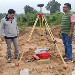
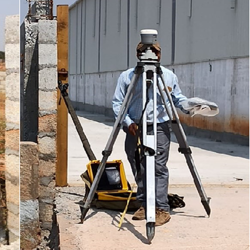
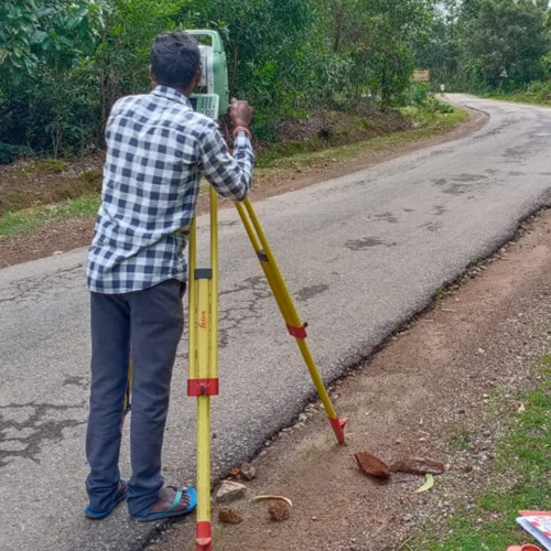
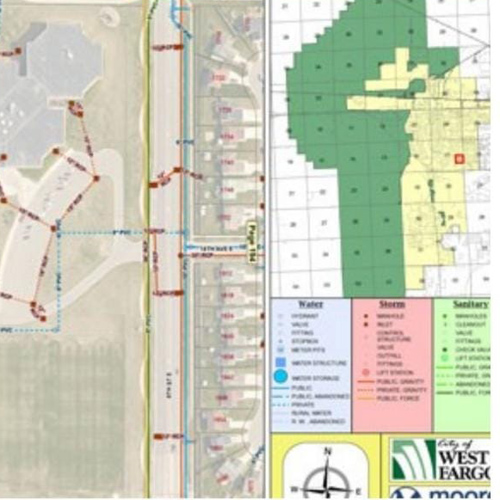
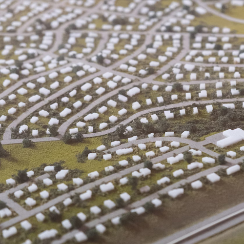
Survey and Topographical Mapping
Scope of Work
It Includes establishment of DGPS / Ground Controls, DT/ST
Leveling, Traversing, Monumentation of Pillars for
Controls/BMs, Boundary and Grid Pillars as per Client
specifications for Pipeline / Road Alignments, Roads,
Irrigation and other infrastructure projects, updation and
macro level mapping.
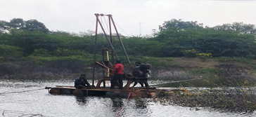
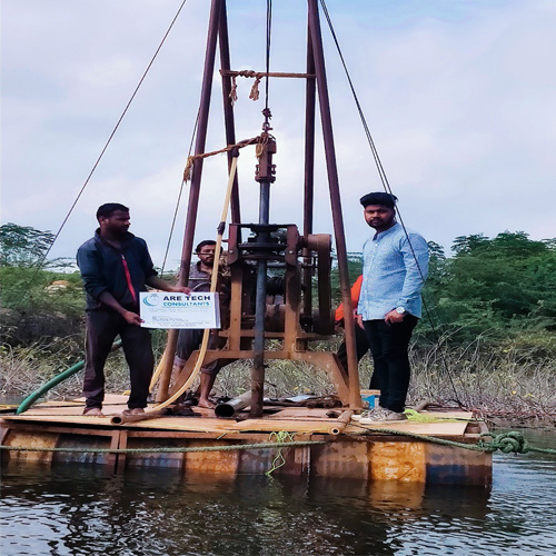
Blow-up Survey, Block level Survey, Hydrological and
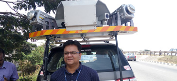
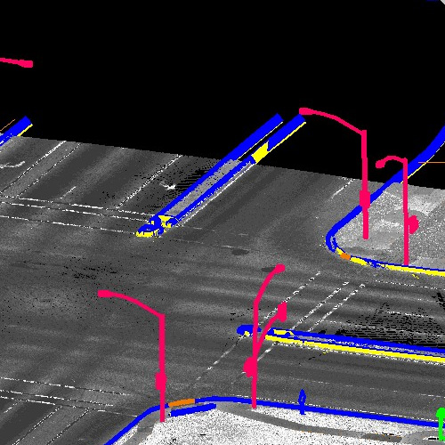
Hydrolographic Survey, Moblie LiDAR and UAV data Collection.
Site / Property Survey, Cadastral / Revenue Survey, including
Collection of document from various, Govt Authorities.
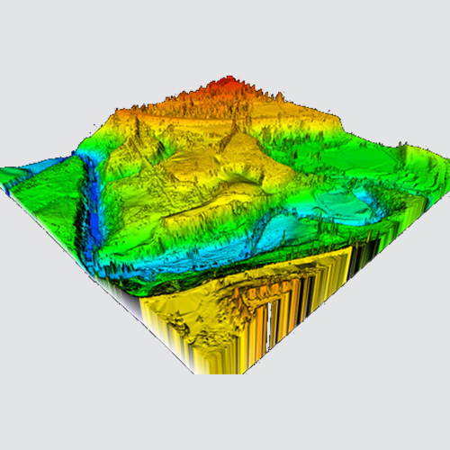
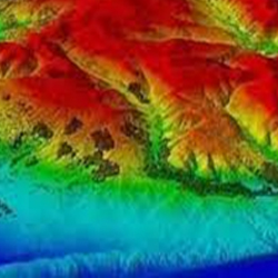
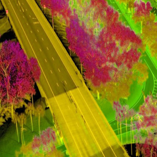
2D/3D terrain Modelling and Deformation Studies.
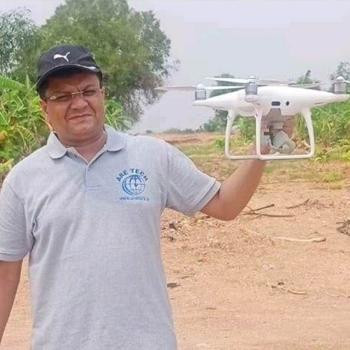
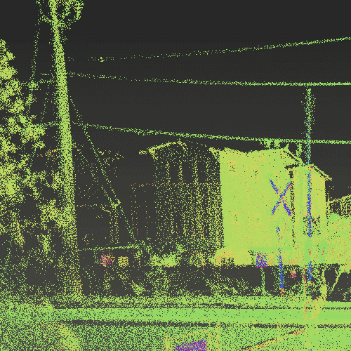
Drone / UAV, mobile LiDAR Survey.
Generation of Planimetry, LS, CS and Blow-up maps using
CAD/GIS.
Desktop Study of Routes / Alignments.
Reconnaissance Survey.
Detailed Engineering Survey and Alignment sheet generation.
Hydraulic & Bathymetric Survey.
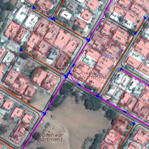
Cadastral & Parcel Mapping. Land Surveying and Mapping.
Irrigation & Highway Engineering and Design.
Feasibility study, Route optimisation, Corridor / Strip
Mapping, RoW Setting out - Road, Rail, Pipelines, Power line,
Canal etc.
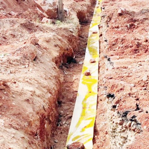
Pipe locating, Underground utilities detection and mapping.
ARETECH undertakes-CAD/GIS Driven services, CAD / GIS Conversion, Digitization, Geo-referencing, GIS compatible Maps and Geo-database creation and maintenance.
Preparation of GIS database for Projects and Maintenance.
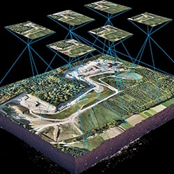
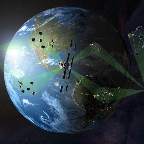
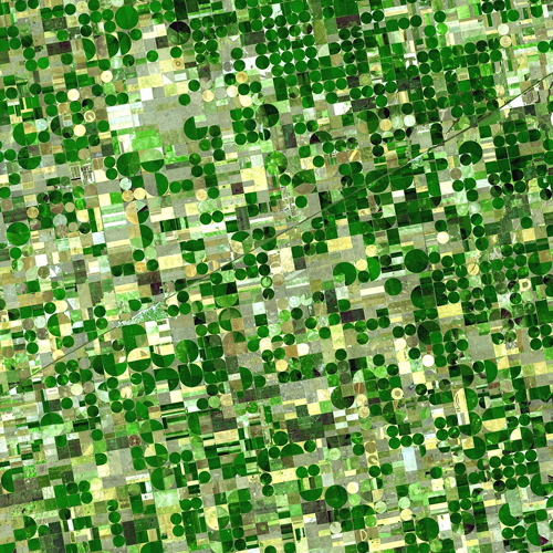
For Global projects, ARETECH offers a full range of LiDAR/ Photogrammetry data compilation services
Digital Terrain Modeling and contour generation 3D city and feature.
Customization for CAD using LISP, LiDAR tool software development and automation
Aerial Photo Mapping
Aerial LiDAR Mapping.
Airborne Geophysical Mapping
3D City and Feature Modeling
Why Are Tech
ARETECH is having extensive experience in Geographical Information Systems (GIS) and Computer Aided Engineering Design (CAD) and Executed handful of works for clients in India and Abroad.
ARETECH specialized in entire spectrum of LiDAR data compilation with experienced staff advanced LiDAR data processing software and work
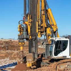
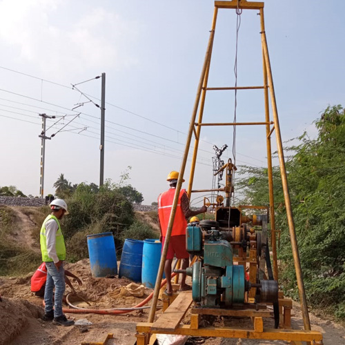
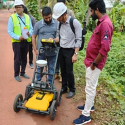
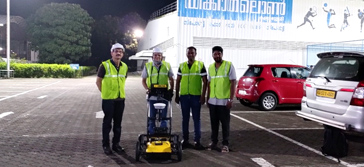
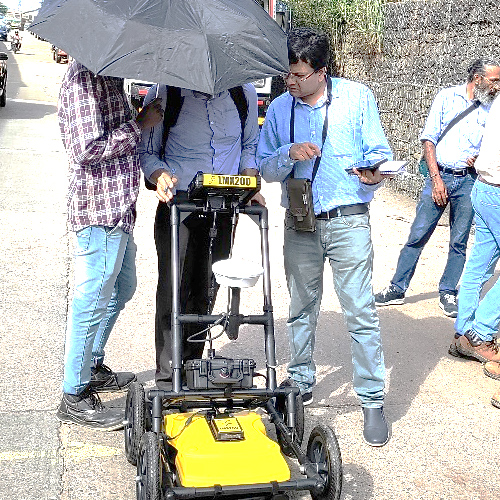
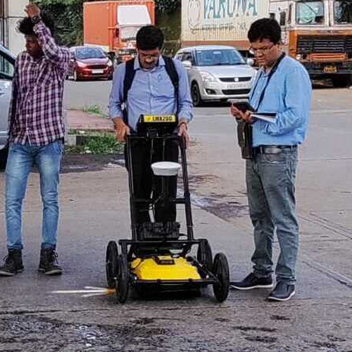
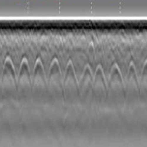
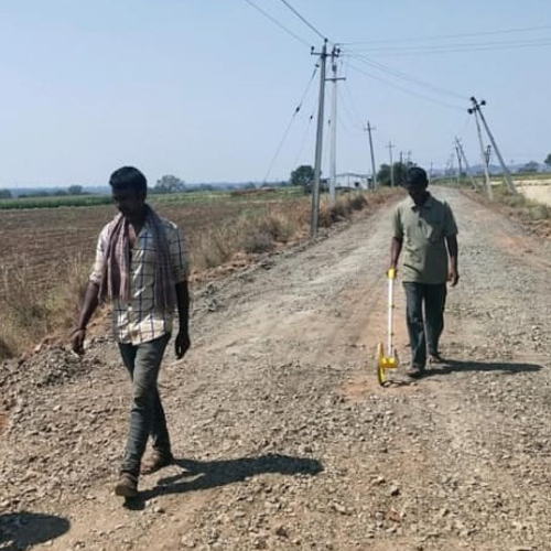
Ground Penetrating Radar (GPR) is used for exploring the sub-surface to determine and validate the presence of underground utilities subject to soil conditions
This technique is ideally suited for RECONFIRMING the presence of any buried underground utilities. Using various antenna options available, the equipment is capable of carrying out utility scan, road scan, bridge scan, profiling and structure scan.
Detection and Interpretation of Buried Utilities, Water, Sewerage, Electrical and Optical Cables also be used for soil stratification including delineation of rock profile upto shallow depth
Pipe Locator shall be for buried Pipeline
Carrying out non destructive testing (NDT)
Why Are Tech
Ground Penetrating Radar (GPR) is one of the latest Geophysical technologies used to detect underground utilities
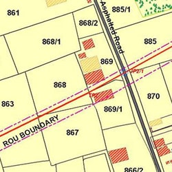
Preparation of Crossing Drawings, Proposals, Joint site inspections, follow-up with concerned Authorities, obtaining Demand Note and Final permissions after necessary payments.
Collection of Revenue Documents / Data, verification of details, Assisting Client for Appointment of Competent Authorities for Project.
Preparation of Schedules for Land Acquisition, Obtaining necessary approval and signature of Competent Authority, submission of notification schedule to Government for Gazette Notification and follow-up for publication in Central Gazette.
Preparation of Erratum and Corrigendum (in both English and Vernacular language) for publication in Gazette.
Notice preparation and serving of notices to land owners for information and objections (If any).
JM survey and preparation of JM sketches. Arranging Objection hearing by CA
Preparation of Final Schedule - 6(1) for Pipeline route and 3(D) in case of Roads and arranging for publication in central gazette after approval by CA.
RoU marking, carrying out Panchanama and collection of Ownership Documents from interested persons / land owners.
Collection of SRO rates for land, Yield & Rates for Crops / Trees and evaluation Reports from Forest Dept., PWD, Irrigation etc.
Preparation of Award for Land, Crops, Horticulture Trees, Forest Trees and Structures etc
Assisting for Distribution of compensation and maintaining records survey number / Owner wise
Preparing GIS compatible documents and Database to upload in GIS Application / Client Server
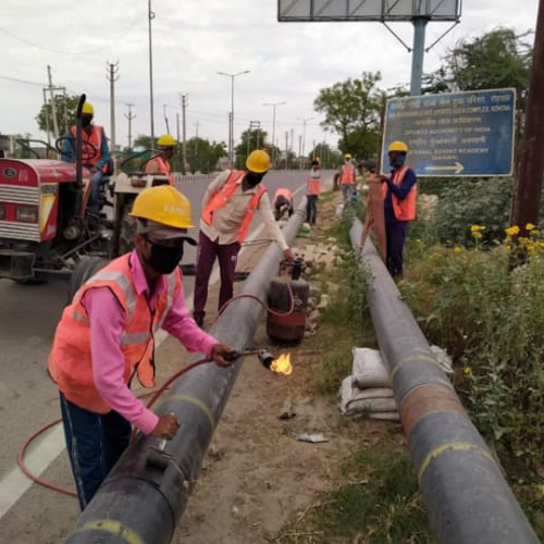
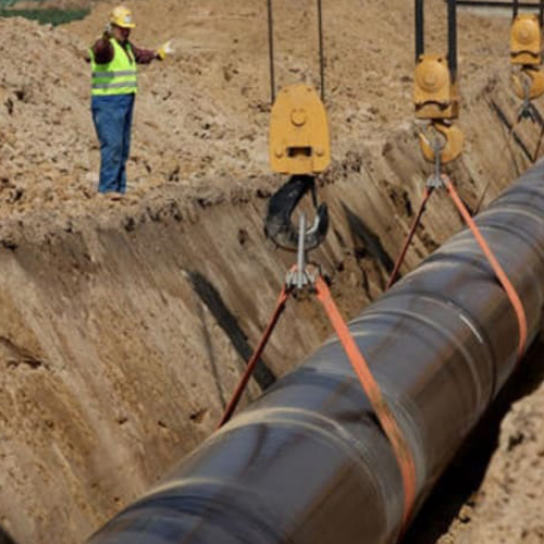
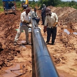
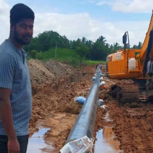
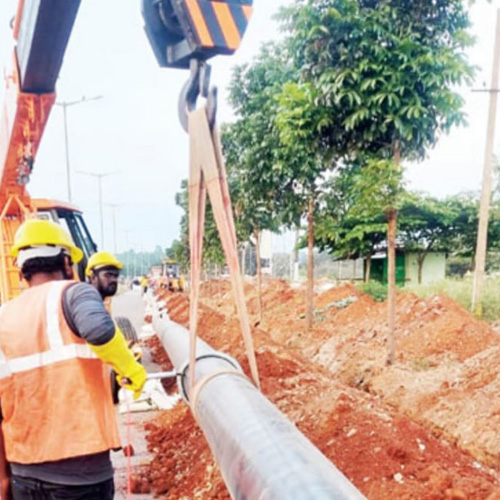
Assisting construction / laying Contractor and providing Team to assist in laying activities.
Preparation of Subsequent Awards and disbursement for additional / new numbers.
Preparation of Closure Notification and handing over to Client.
Why Are Tech
Crossings & Forest Permissions / Approvals from various Authorities
RoU / RoW services for Pipeline & Road Projects.
Permanent Land Acquisition services for SV/CP/IP/PS/RT/DT/TOP & Terminal Stations.
ARETECH undertakes-CAD/GIS Driven services, CAD / GIS Conversion, Digitization, Geo-referencing, GIS compatible Maps and Geo-database creation and maintenance.
Preparation of GIS database for Projects and Maintenance
For Global projects, ARETECH offers a full range of LiDAR/ Photogrammetry data compilation services.
Digital Terrain Modeling and contour generation 3D city and feature
Customization for CAD using LISP, LiDAR tool software development and automation
Digital Terrain Modeling and contour generation.
3D city and feature Modeling
Asset Management (Power line, Pipeline, Highways)
Heritage, Tunnel and as-built mapping
Geodatabase creation
Customized LiDAR tool software development and automation
For global projects, ARETECH offers a full range of LiDAR data compilation services
ARETECH specializes in the entire spectrum of LiDAR data compilation with experienced staff, advanced LiDAR data processing software and workstations.
Why Are Tech
ARETECH is having extensive experience in Geographical Information Systems (GIS) and Computer Aided Engineering Design (CAD) and Executed handful of works for clients in India and Abroad
ARETECH specialized in entire spectrum of LiDAR data compilation with experienced staff advanced LiDAR data processing software and work.
ARETECH offers a full range of Digital Photogrammetry processing services
ARETECH performs Photogrammetry services from both Aerial Photographs and Stereo Satellite Images for all the latest Aerial and Satellite Photography sensors.
Aerial Triangulation for Aerial Photos/Exterior Orientation (EO) for Satellite Imagery.
Topographic/Planimetric Mapping and Updating.
DEM/DTM/ Contour Generation.
Orthophoto generation/ Mosaicing / Tiling
3D City and Feature Modeling.
Close Range Photogrammetry.
Vision Map and IFSAR Photogrammetry.
Why Are Tech
Excellence and Innovation built into every design
Are Tech has experience in the field of Data capture, Processing using latest Technology
Data collection of Details of Existing utilities, As-Build maps of Roads, Water supply, Water Supply, Sewage, Storm Water Drainage, Electrical, Street-Lighting and Telecommunication Network including WTP, EWT, GLT, PS locations, STP, Pressurised / Gravity networks, Substations, Telephone Exchanges etc.
Survey, Investigation, study of existing network, design criteria, EIA/EMP studies, Client requirements, Design Demand and other requirements.
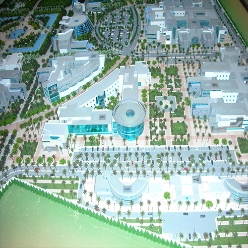
Understanding the Client Requirements, we offer a personalized service to create spaces and buildings that delight and add values.
Offers best services beginning with Site measurement, sketch concept options, through to full planning permission and delivery on site. We provide 2D floor plans, 3d Elevations, 3D Interior views / Walk through, Landscape Design, Electrical, Plumbing, Structural Drawings.
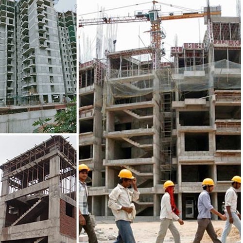
Site supervision in accordance with technical and construction related legal requirements.
Continuous supervision of construction works (quality, schedule and budget). Building Information Modeling services (BIM) for civil, buildings and industrial projects.
Independent third-party verification and certification.
Project management consultant for building, industrial and infrastructure facilities.
Programme management consultant for infrastructure development plans.
Site supervision in accordance with technical and construction legal requirements.
Continuous supervision of construction works (quality, schedule and budget).
Commissioning supervision on quality and schedule.
Facility management and maintenance supervision of infrastructure and building.
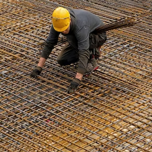
Testing materials, systems and installations.
Non-destructive testing supervision.
Delivered documentation supervision.
Technical and legal advice, and assessment consulting.
As-built documentation.
Permanent supervision by experienced professionals.
Programme management of infrastructure projects .
Building Information Modelling services (BIM) for civil, buildings and industrial project
Why Are Tech
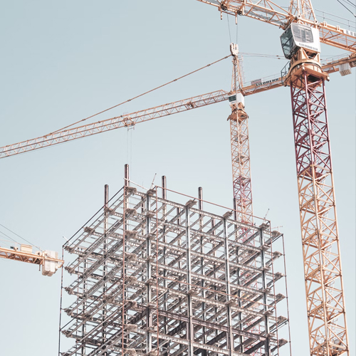
ARETECH have in-house reliable and skilled Architects, Masons, Engineers and Quality Surveyors to assist in bringing the projects to life
We are specialized in all types of construction works, Housing, Delivering New Building, Renovations, Construction Supervision and Project Management.
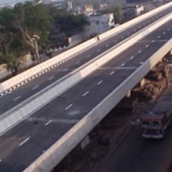
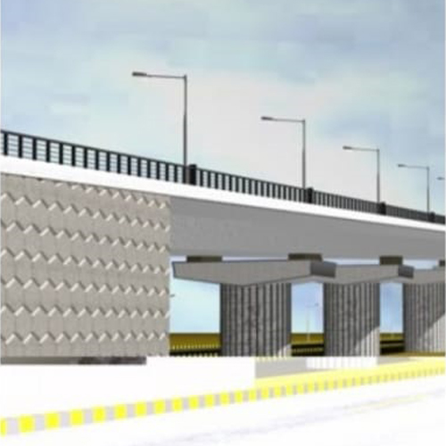
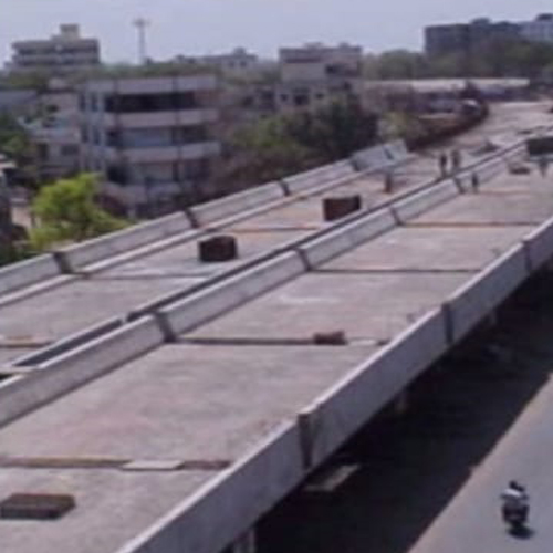
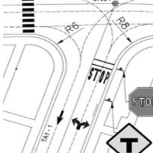
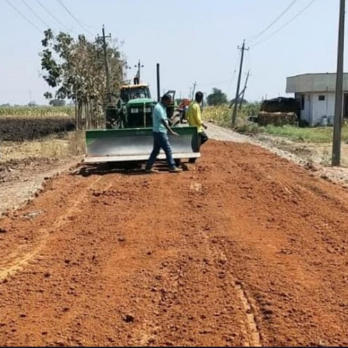
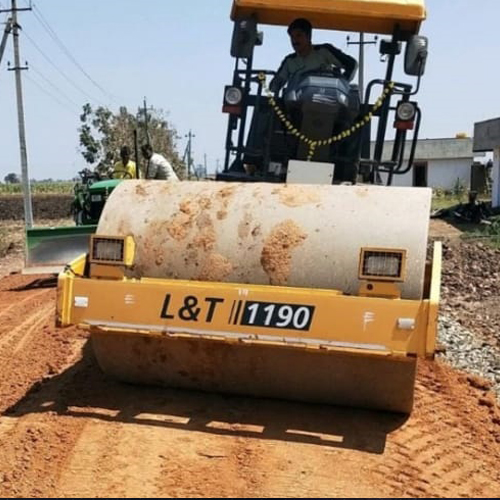
In Highway Engineering, ARETECH providing consultancy services involving design and supervision for all types of road development works including bridges.
We integrate international standards in our designs including specifications defined by Indian Road Congress (IRC) and Ministry of Road Transport and Highways (MoRT & H).
We prepare Detailed Project Reports (DPR) and offer Project Management Consultancy (PMC) services.
Alignment studies, Preliminary Route finalization, mapping and generation of 3D corridor & alignment, Terrain evaluation using latest technology such as Stereo Satellite images and Terrestrial LiDAR
Feasibility Study of Road Corridor, Survey Control, Data capture by Modern Technology, Preliminary and Final Location Survey
Geotechnical, Material, Pavement and Subgrade Investigations
Hydraulic and Hydrological Investigations.
Traffic and Social Surveys including Analysis.
Environmental Impact Study, Management and Clearance.
Turnkey Land Acquisition and Computerization of Land Records.
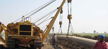
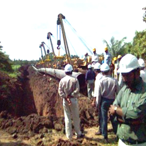
Planning of Integrated pipeline network development for connecting major consumer centres such as Special Economic Zones (SEZ), Industrial units, Power plants, Fertilizer units and commercial establishments including related investigations And GIS/GPS/Remote Sensing based Feasibility studies for identification of Route for laying cross country pipelines.
GIS based Route optimisation studies considering factors such as Terrain, Land Development, Environment clearance, Ease of Construction, Land cost, Accessibility for O&M, pipeline Economics and other constraints.
Preliminary 3D analysis of pipeline corridors using latest satellite stereo images, generation of Alignment Sheets, Cadastral mapping including generation & management of ownership details.
Detailed Hydrological Studies for pipeline crossing locations of water bodies including major rivers with firm recommendations regarding depth of pipeline burial.
Stability analysis including slope protection works on turn key basis (EPC) for laying pipeline in highly erosive type of soil, Ghat regions & hilly terrains.
Project Management Consultancy Services (PMC) for pipeline construction involving Quality Monitoring, Progress Monitoring, Certification of bills and close out reports.
Development of accurate Base maps and GIS database using high resolution satellite imageries for showing present and future development to facilitate prioritisation of development of Gas distribution network
Study of Demand and Supply by undertaking field survey and interaction with all concerned statutory bodies including projection of future growth to create a master database of Demand centres.
IT enabled project monitoring applications including for Quality measures, online/web progress reporting systems
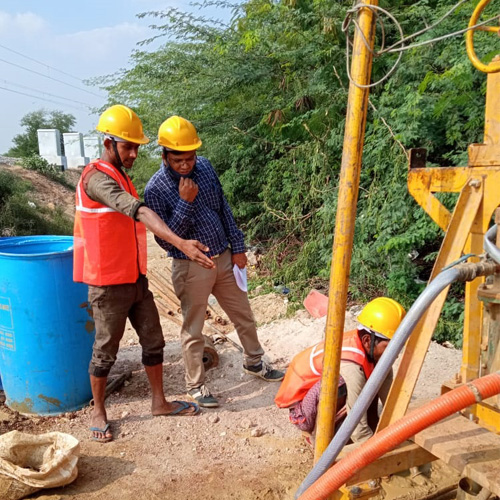
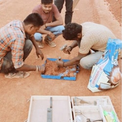
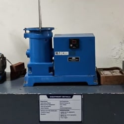
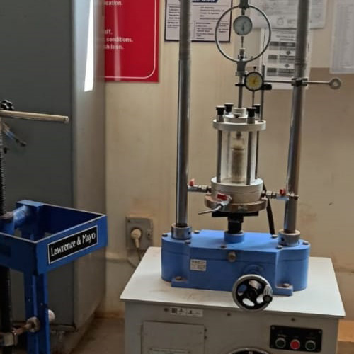
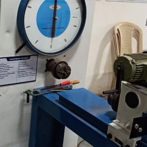
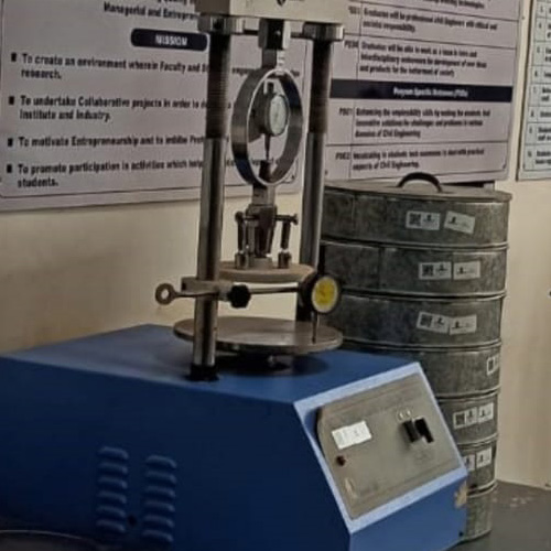
ARE TECH Consultants is working together with reputed Engineering College proffessors and have MOU to use their Civil Engineering Laboratory with well-equipped, calibrated and fully functioning Material Testing Laboratory Equipments.
We assist clients with more than just materials testing, often providing invaluable advice and support through a highly experienced network of staff and wealth of information that has been collected for over the years.
ARETECH offer a full range of testing services necessary in the construction and maintenance of infrastructural assets such as Bridges, Roads & Highways, Airfield pavement, Buildings and other Infrastructure works. Our team shall meet the End client specifications by providing independent consultation services. We conduct laboratory tests for the following items:
ARETECH’s Project Management team have expertise in developing indigenous techniques of planning, organizing, monitoring, quality control, cost control and managing resources to achieve successful completion of project goals and objectives within the specified budget and time taking into consideration relevant specifications as applicable including local conditions.
We have strict Health, Safety, and Environment (HSE) policy.
Planning
Scheduling
Monitoring
Quality Control
Cost Control
Resource Management
Quantity Measurements
Bill Certifications
Risk management
Reporting
Why Are Tech
We develop project specific WEB based Construction Progress Monitoring applications so that up to date information is available to all stake holders.