CAD, GIS, PHOTOGRAMMETRY & SATELLITE DATA PROCESSING
Excellence and Innovation built into every design
Services we provide
CAD, GIS, Photogrammetry and Satellite Data Processing
Scope of Work
ARETECH undertakes-CAD/GIS Driven services, CAD / GIS Conversion, Digitization, Geo-referencing, GIS compatible Maps and Geo-database creation and maintenance.
Preparation of GIS database for Projects and Maintenance
For Global projects, ARETECH offers a full range of LiDAR/ Photogrammetry data compilation services.
Digital Terrain Modeling and contour generation 3D city and feature
Customization for CAD using LISP, LiDAR tool software development and automation
Asset Management (Power line, Pipeline, Highways)
Heritage, Tunnel and as-built mapping
GIS
Integrated geospatial data processing and web enabled enterprise GIS software development
Individuals perform geospatial modeling or spatial analysis
Designs and edits GIS data for numerous projects
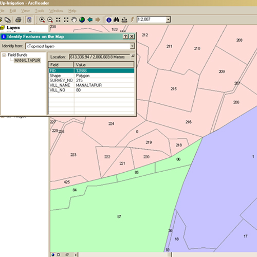
Land information systems for cadastral data and corridor mapping
Parcel mapping, land use / land cover classification and preparation of base maps
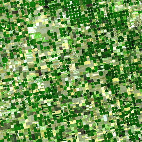
Floodplain mapping and watershed modeling
Over the years, we have been involved in delivering geographic information services like mapping, collection, gathering, storing, processing, integrating, managing, analysing, and distributing map data.
Photogrammetry
Scope of Work
ARETECH offers a full range of Digital Photogrammetry processing services
ARETECH performs Photogrammetry services from both Aerial Photographs and Stereo Satellite Images for all the latest Aerial and Satellite Photography sensors.
Aerial Triangulation for Aerial Photos/Exterior Orientation (EO) for Satellite Imagery.